Drone Imagery
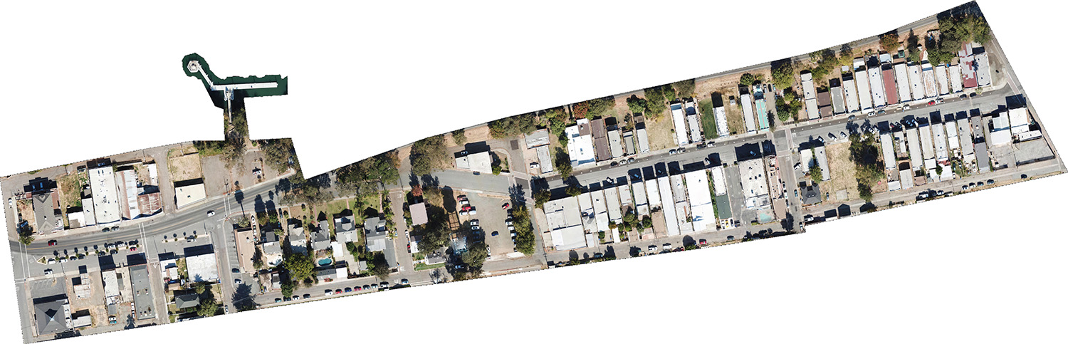
Explore recent drone imagery below, zoom in and pan around to see detail. Obtained with our Mavic Pro for use in our parking study for… Read More »Drone Imagery
Explore recent drone imagery below, zoom in and pan around to see detail. Obtained with our Mavic Pro for use in our parking study for… Read More »Drone Imagery

Montrose County staff and key stakeholders worked with us to develop and update the county’s hazard mitigation plan that was created in 2009. The county’s… Read More »Montrose County’s Hazard Mitigation Plan Update
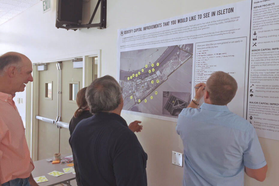
A community workshop was held on July 15, 2017 to inform future planning projects in Isleton. Over 20 members of the community participated in the… Read More »Isleton Community Workshop
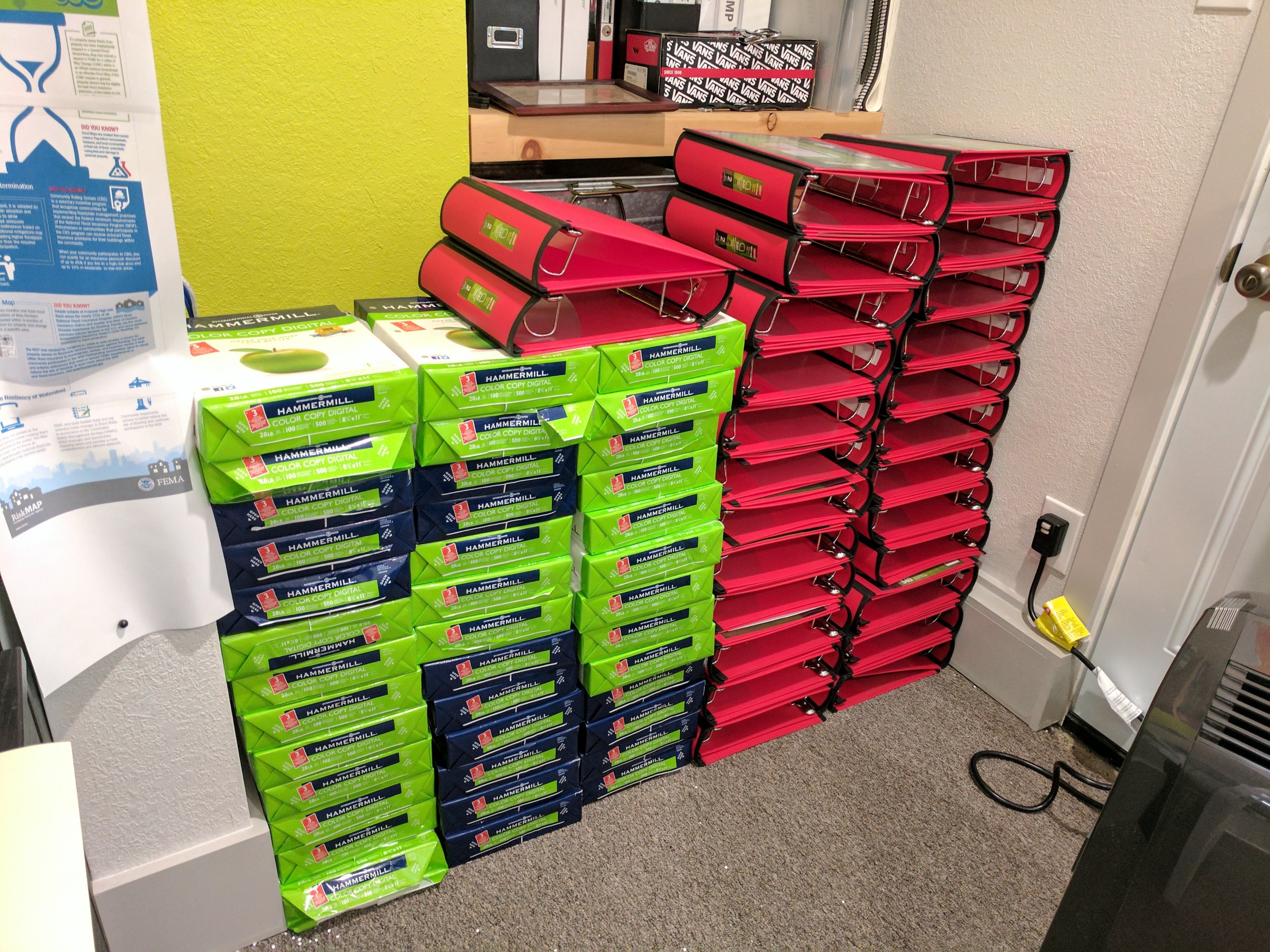
Busy week ahead on print production for 50 EOP binders. Raw materials. Prototype binder. Flash drives and CDs that go with each binder.
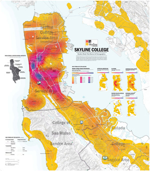
We just completed a cartography and GIS project for Skyline College’s Office of Planning, Research and Institutionsal Effectiveness (PRIE). These handsome maps are each 35″… Read More »Skyline College Mapping
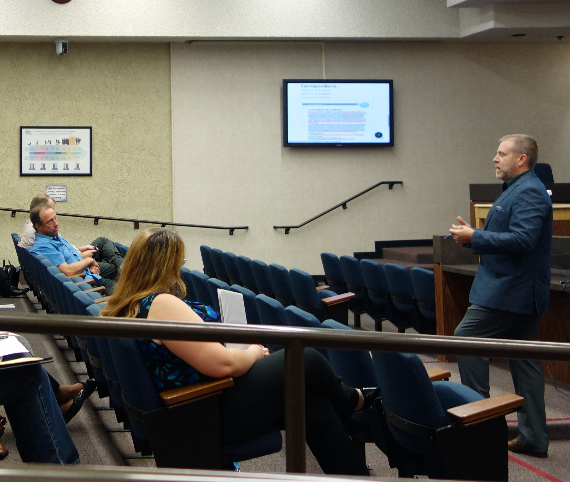
We are proud to announce that work for the County of San Bernardino’s Hazard Mitigation Plan Update project is underway. Our kick-off meeting was great… Read More »San Bernardino Hazard Mitigation Plan
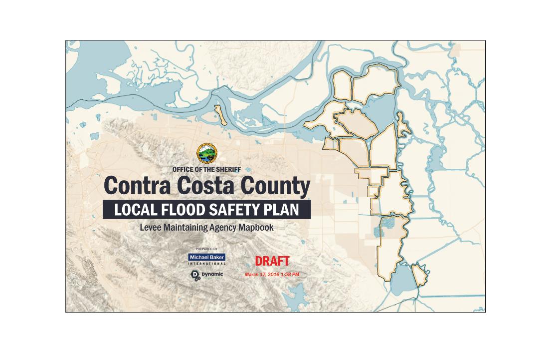
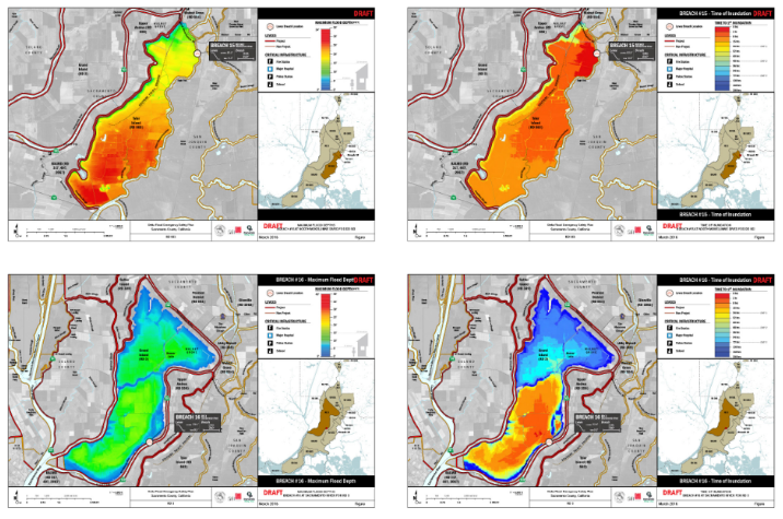
Check out this thumbnail overview of a few pages of the 150+ pages in Contra Costa County’s Flood Safety Plan maps. Made with ArcMap, Illustrator,… Read More »CCC Flood Safety Plan Maps
Here’s a thumbnail overview of a few of the 50+ maps we’re doing in Sacramento County. Made with ArcMap, Illustrator, Photoshop and InDesign.
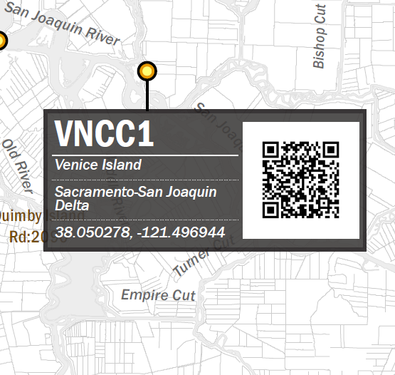
This is an overview of a script I developed utilizing python urllib, google’s chart api, and NOAA’s live stream monitoring charts. I created this proof of concept… Read More »Python to batch generate QR codes
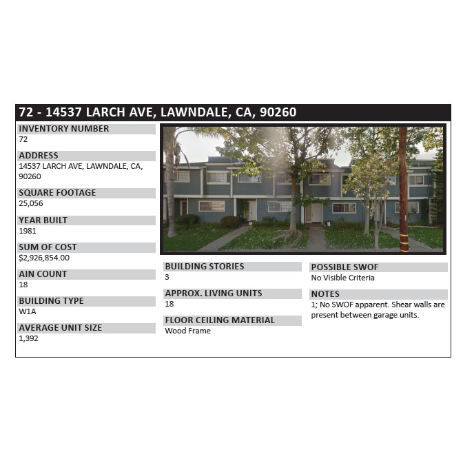
I wrote this script to download google streetview images locally for a list of addresses in a text file, one address per line. It’s an… Read More »Scraping Streetview for a Soft Story Structure Catalog