[cs_heading column_size=”1/1″ cs_heading_title=”Tehama County HMP Update” cs_heading_style=”1″ cs_heading_align=”center” cs_heading_divider=”off” =”null” cs_heading_font_style=”normal” cs_heading_color=”#2e2e3a”]Please explore the content below to see some of our work detail.[/cs_heading]
[cs_divider cs_divider_style=”crossy” cs_divider_backtotop=”no” cs_divider_height=”1″]
Dynamic Planning + Science’s Response to Tehama County HMP Update RFP
DP+S RESPONSE DOCUMENT [pdf file, 13MB total]
This download contains 1 PDF format version of our RFP response document.
[cs_divider cs_divider_style=”zigzag” cs_divider_backtotop=”no” cs_divider_margin_top=”3″ cs_divider_margin_bottom=”3″ cs_divider_height=”3″]
Dynamic Planning + Science Work Samples
[cs_divider cs_divider_style=”zigzag” cs_divider_backtotop=”no” cs_divider_margin_top=”3″ cs_divider_margin_bottom=”3″ cs_divider_height=”3″]
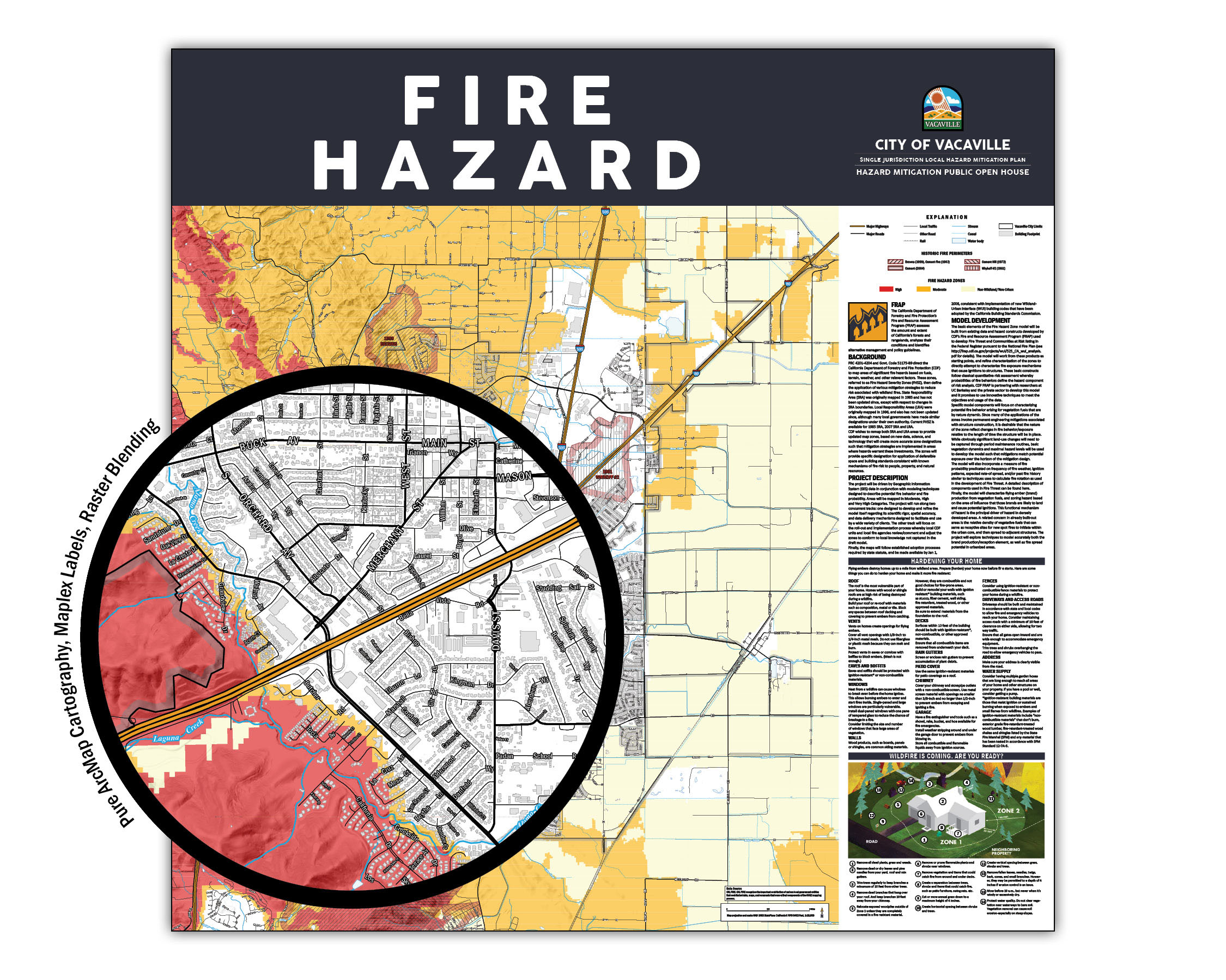
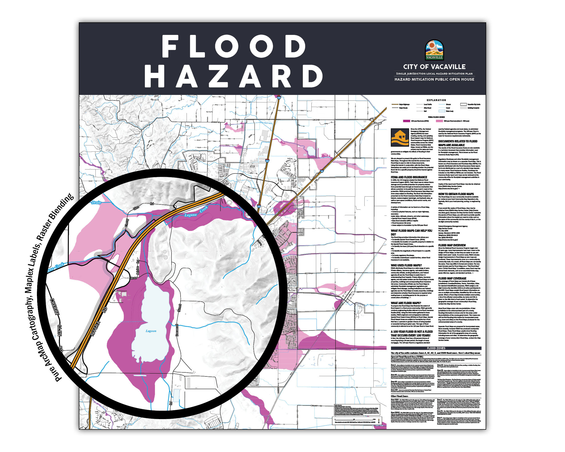
City of Vacaville Outreach and Public Open House Hazard Overview Mapping
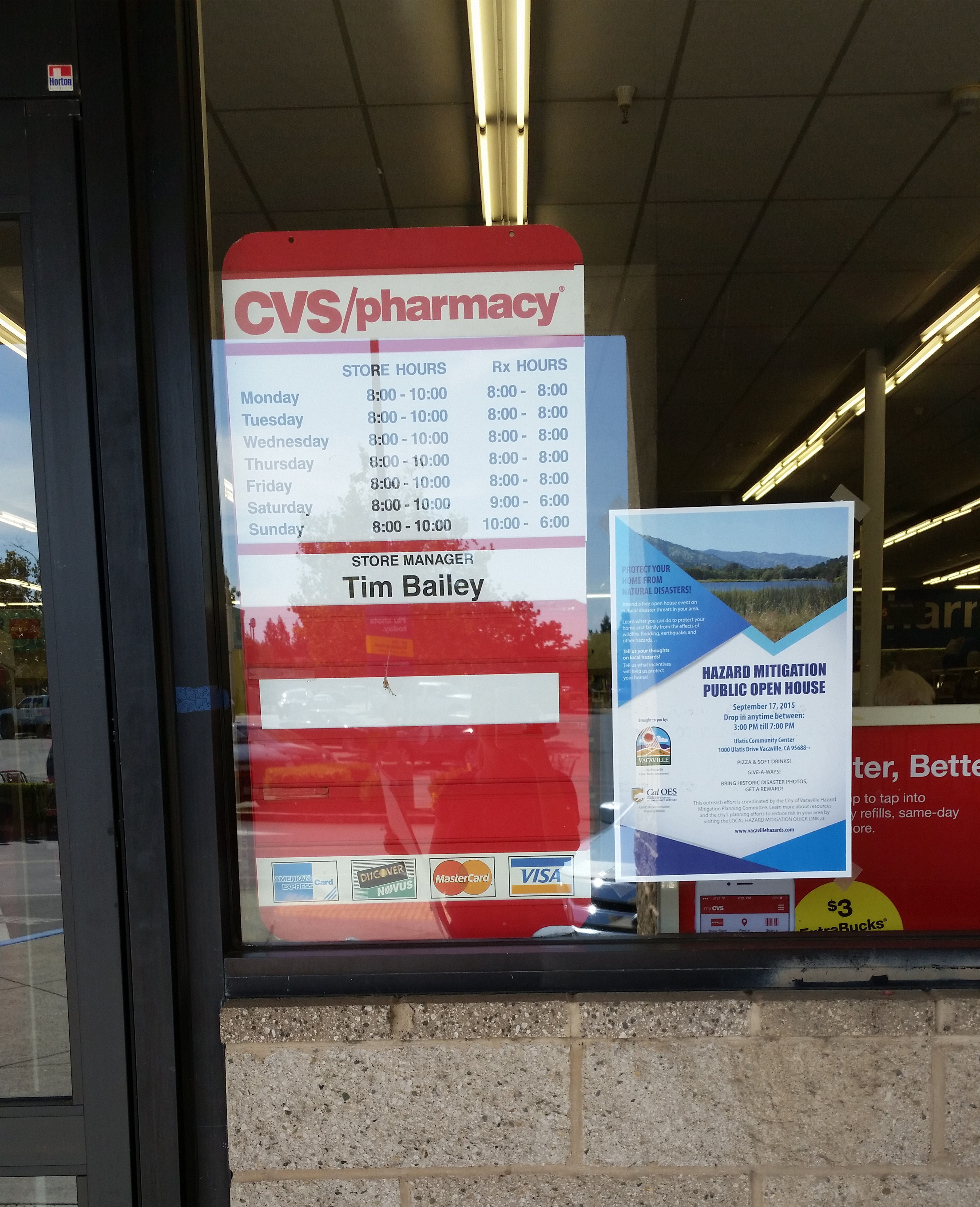
Targeted poster outreach for public engagement.
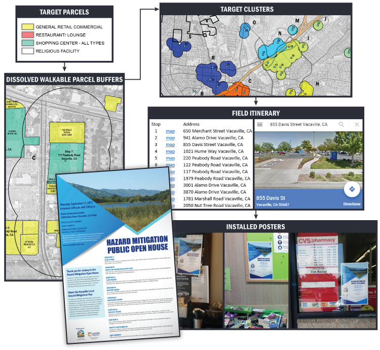
Public open house posters in the wild.

Sample utility mailer stuffer.

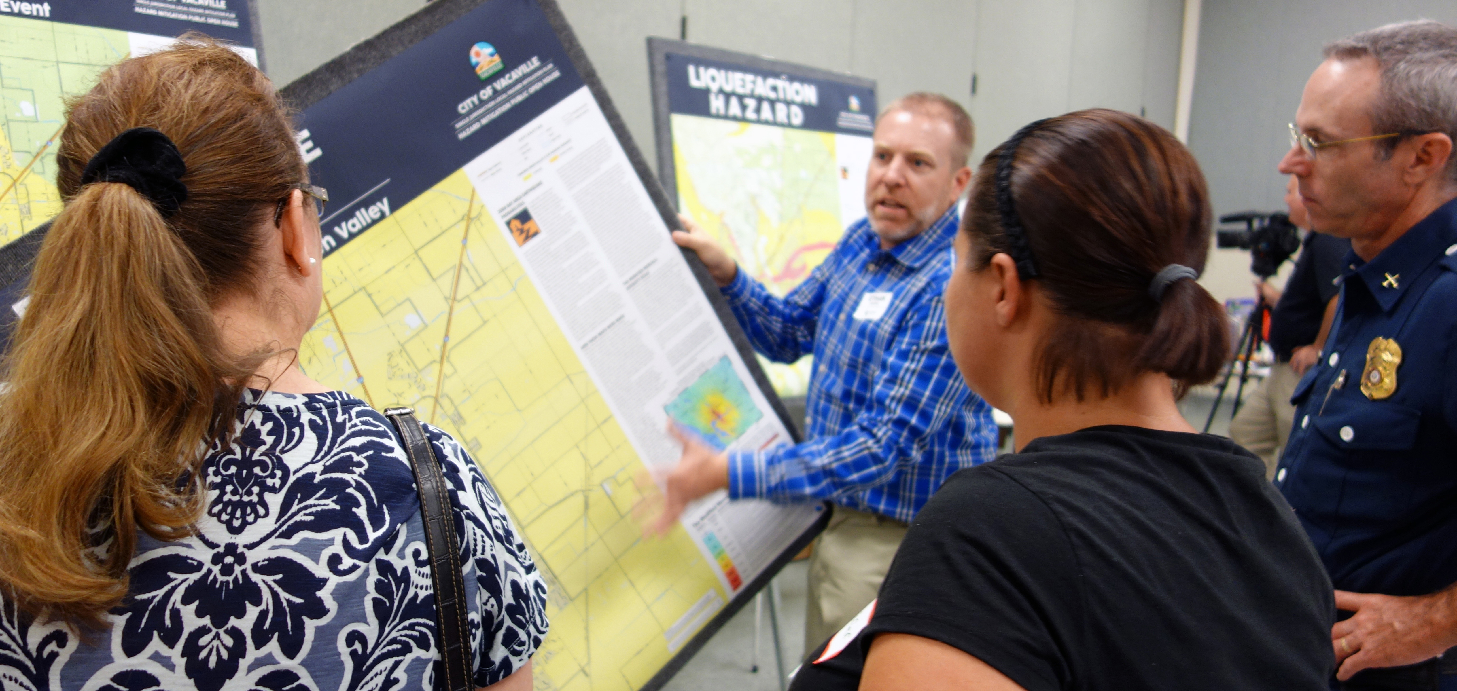
Ethan at City of Vacaville Public Open House.
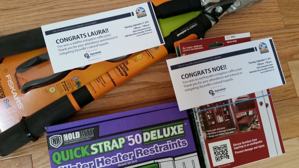
Raffle prizes from Open House – hand-delivered by DP+S.
[cs_divider cs_divider_style=”zigzag” cs_divider_backtotop=”yes” cs_divider_margin_top=”3″ cs_divider_margin_bottom=”3″ cs_divider_height=”3″]
Contra Costa County Flood Safety Plan Public Safety & Flood Contingency Mapping
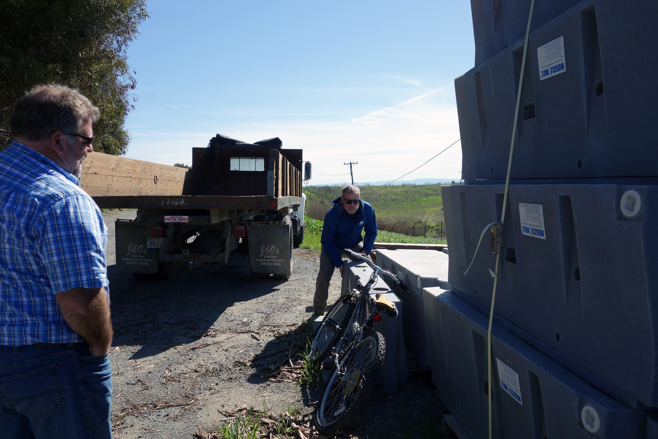
In the field with local engineering and stakeholder on Bradford Island, in the California Delta.
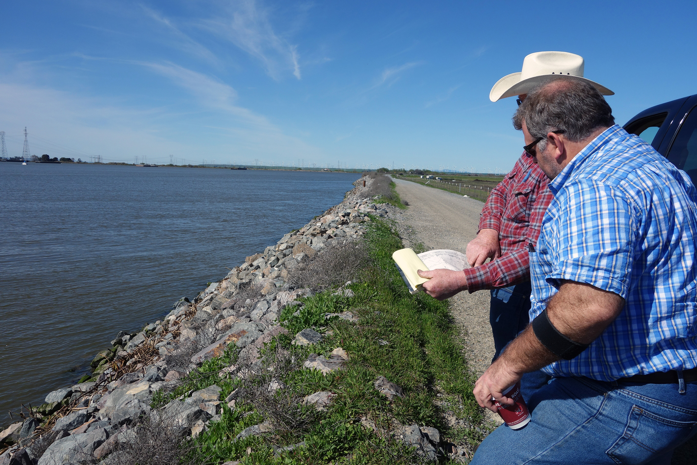
Reviewing flood fight material, Bradford Island.
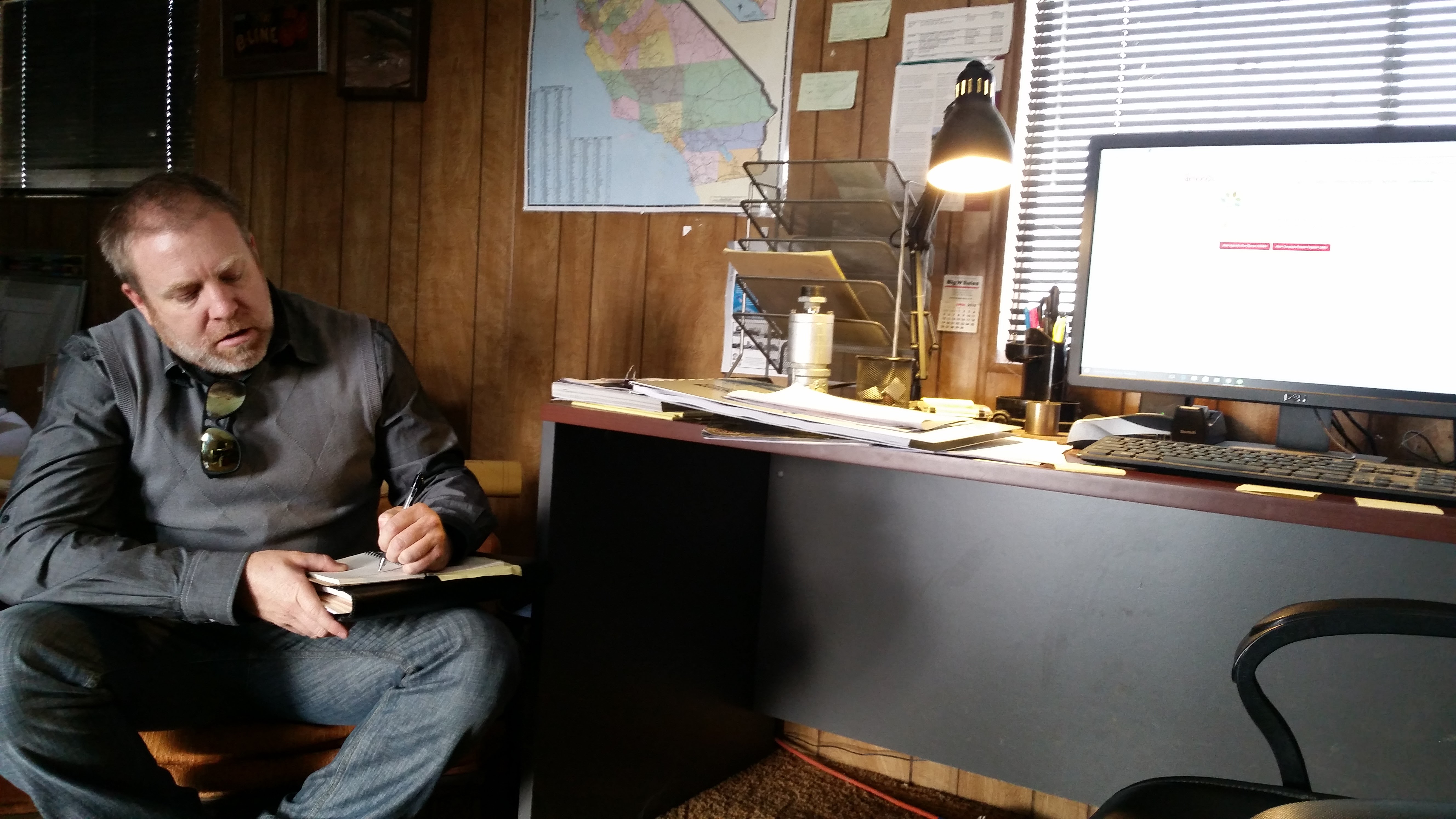
At local Levee Maintenance Agency field office, Bixler Tract, California Delta.
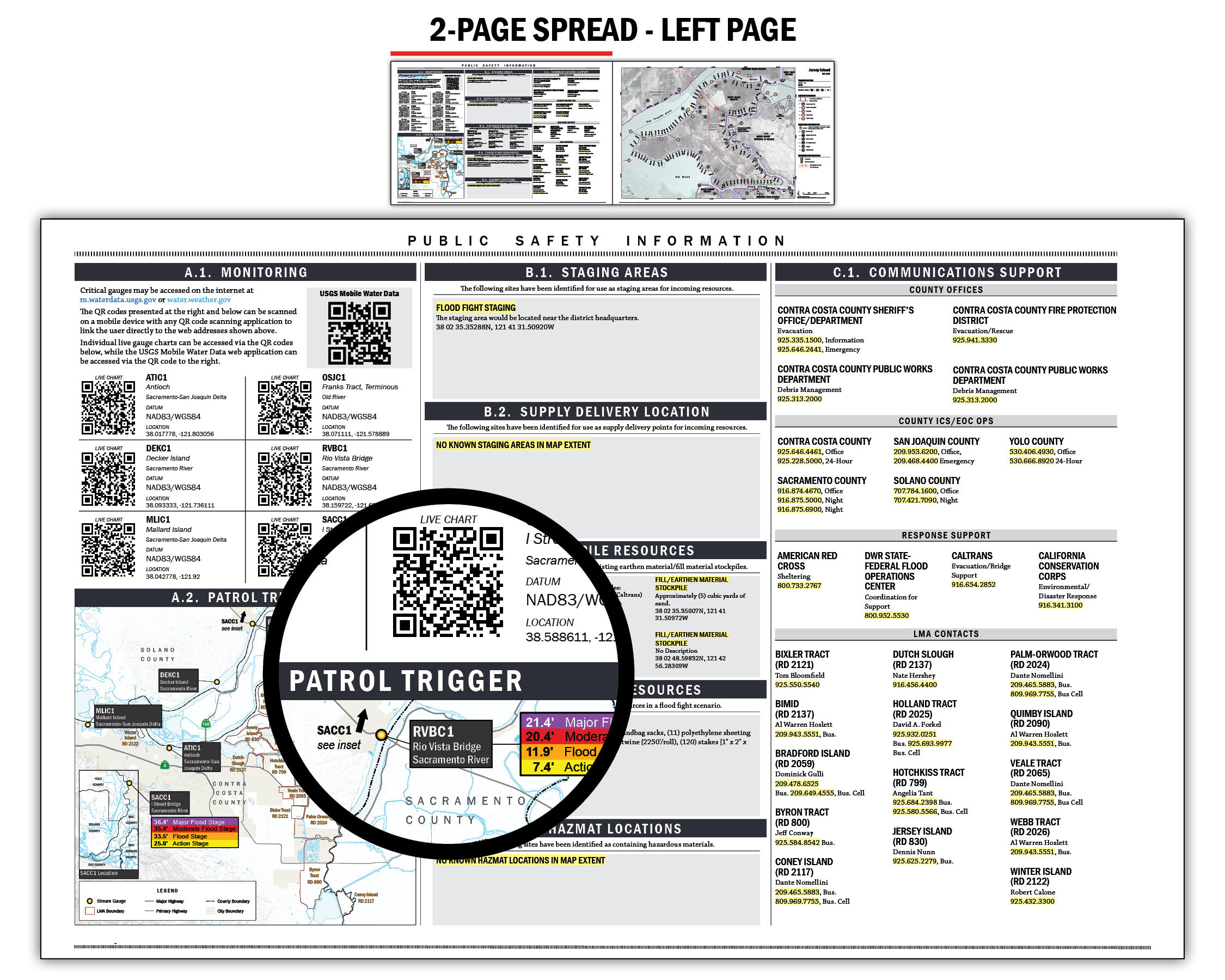

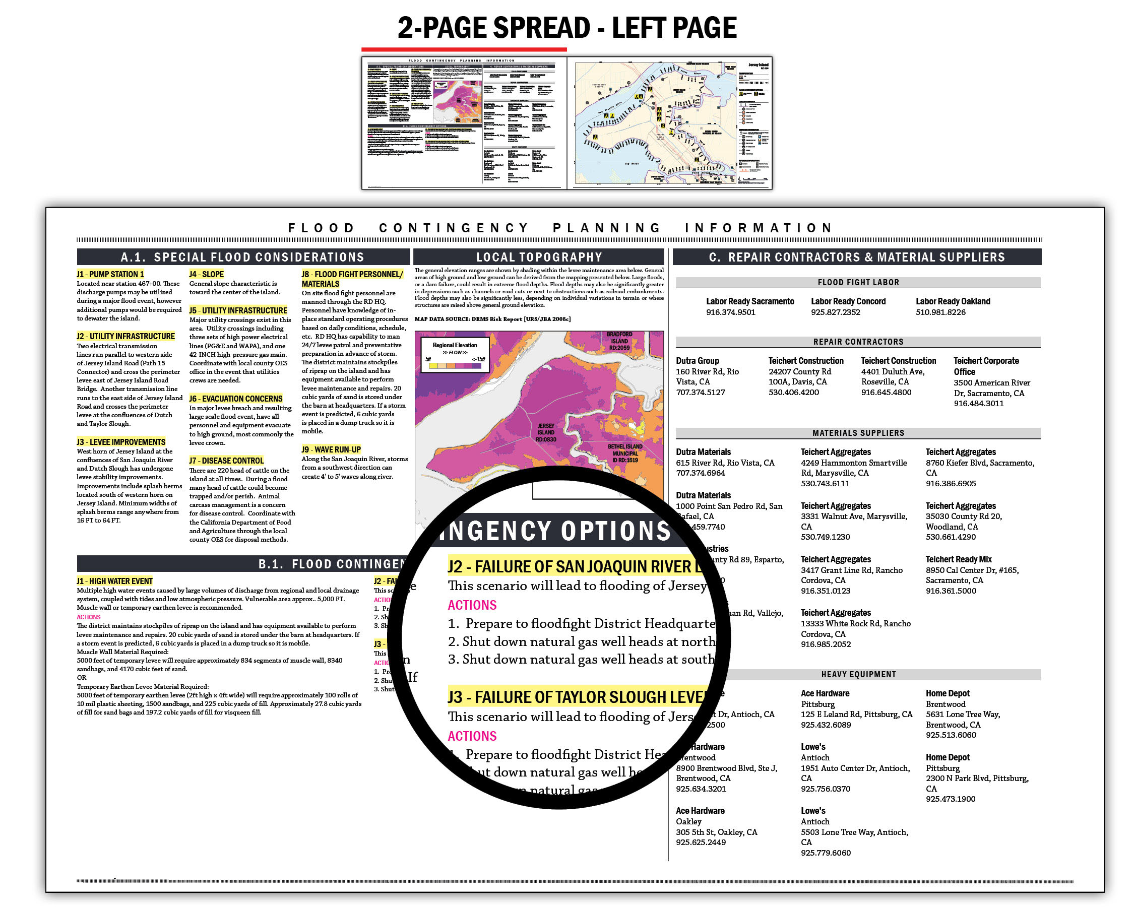

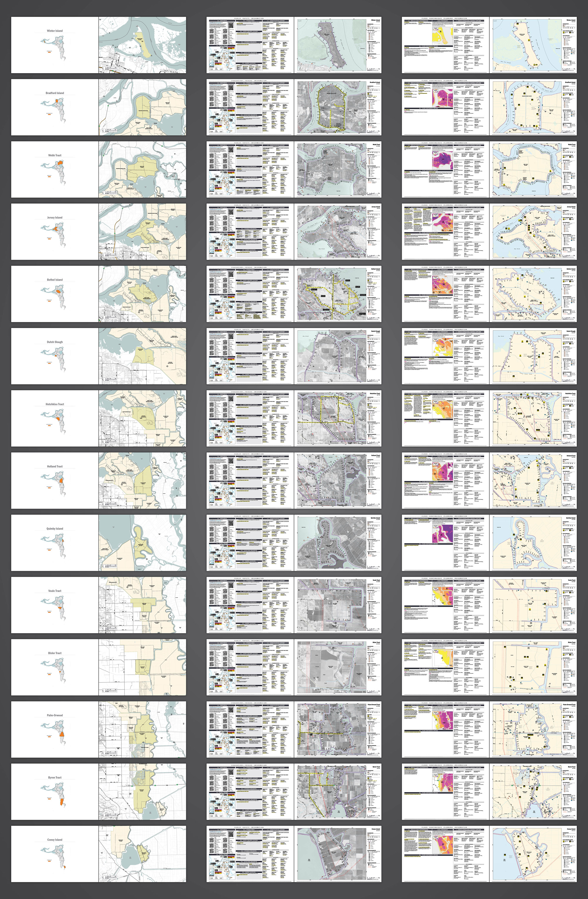
Each of Contra Costa County’s 14 Levee Maintaining Agencies are mapped in 3 unique spreads over a 93-page mapbook including a divider spread, a public safety spread and a flood contingency spread.
[cs_divider cs_divider_style=”zigzag” cs_divider_backtotop=”yes” cs_divider_margin_top=”3″ cs_divider_margin_bottom=”3″ cs_divider_height=”3″]
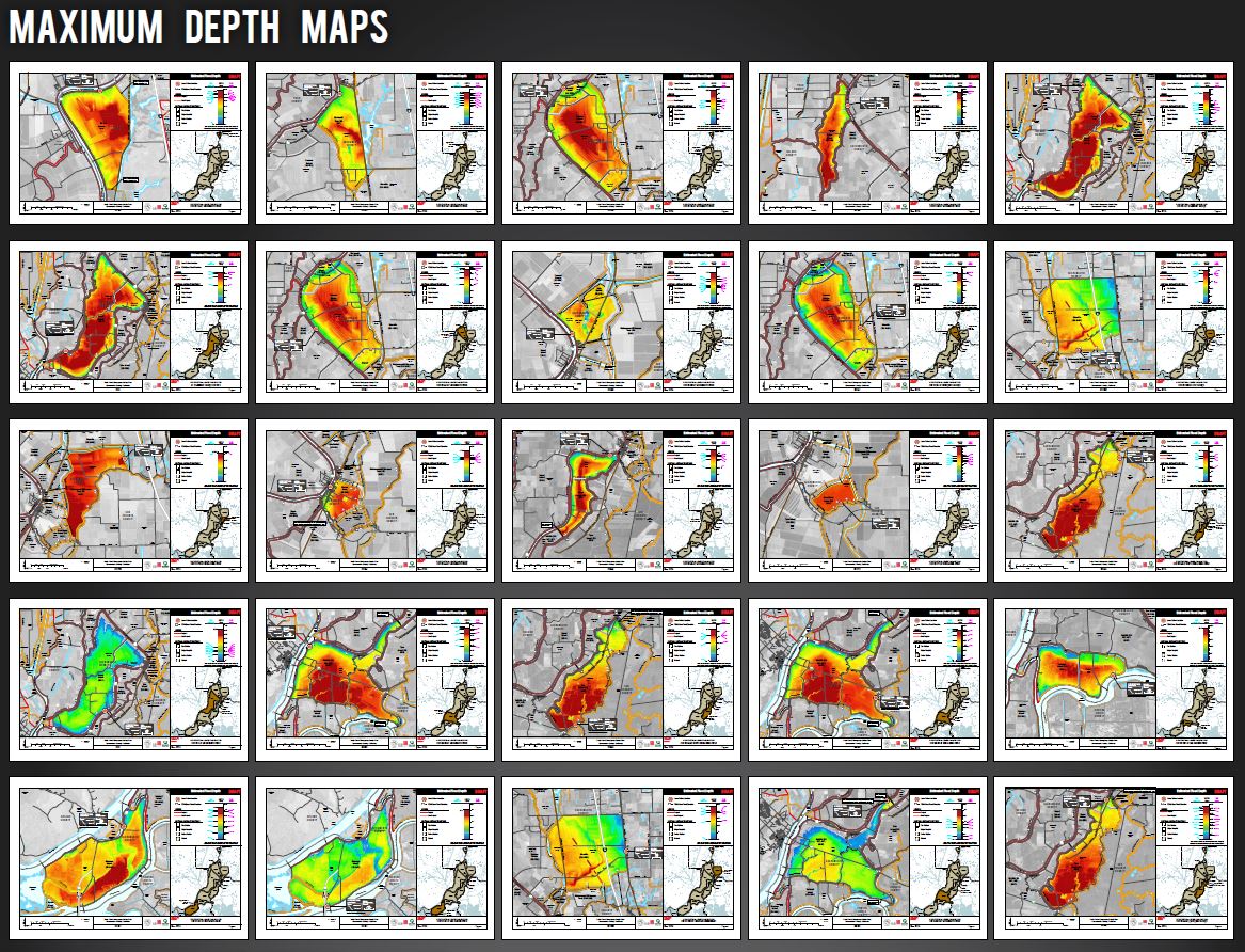
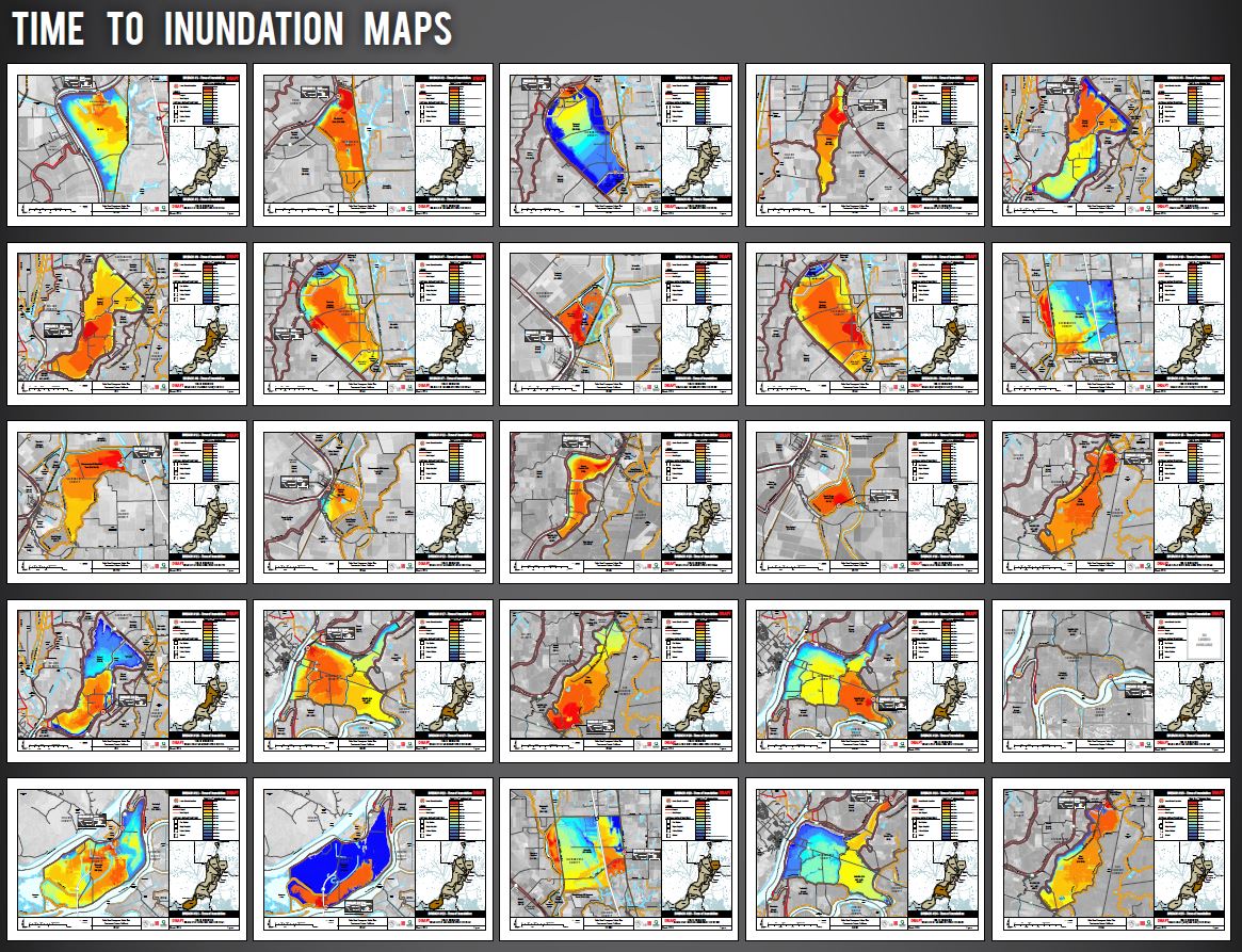
Sacramento County Flood Safety Plan Flood Depth & Time of 1-foot Inundation Mapping
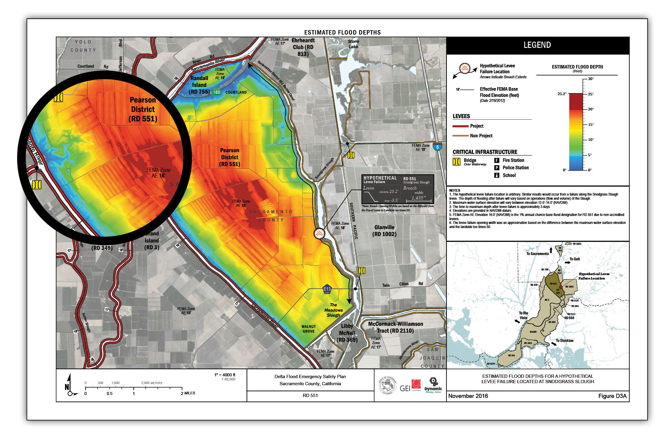
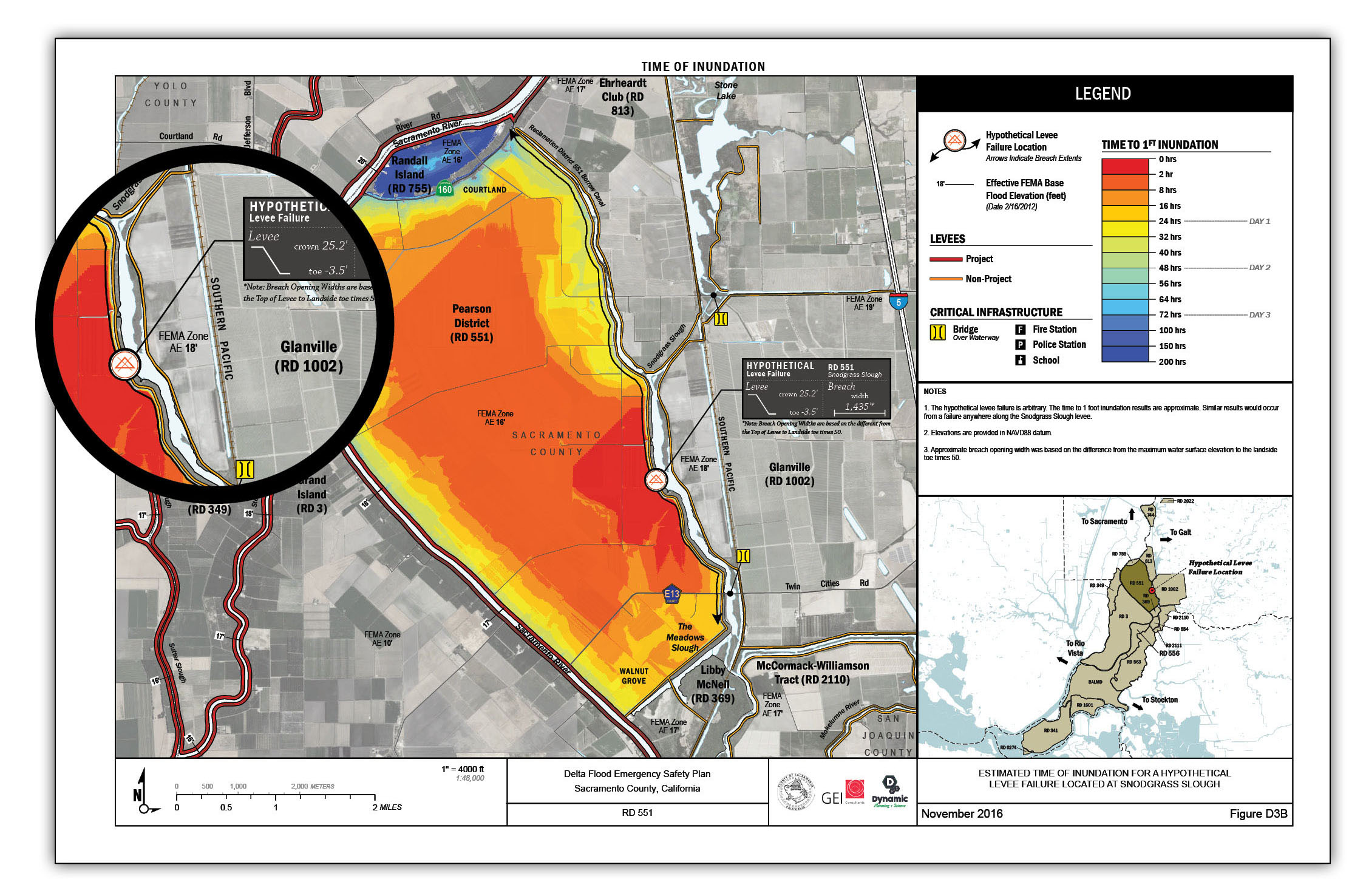
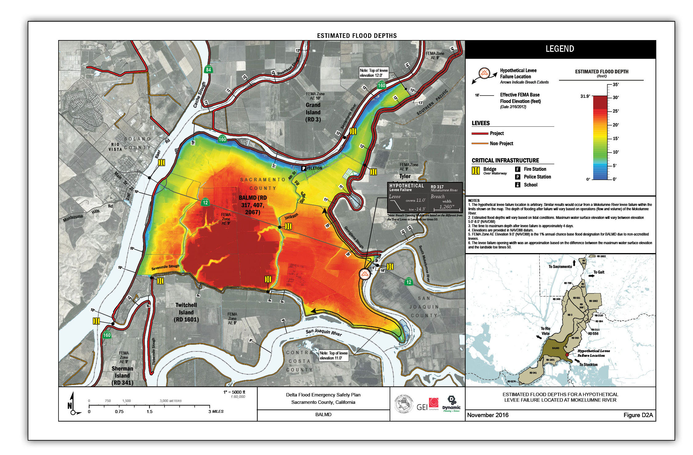
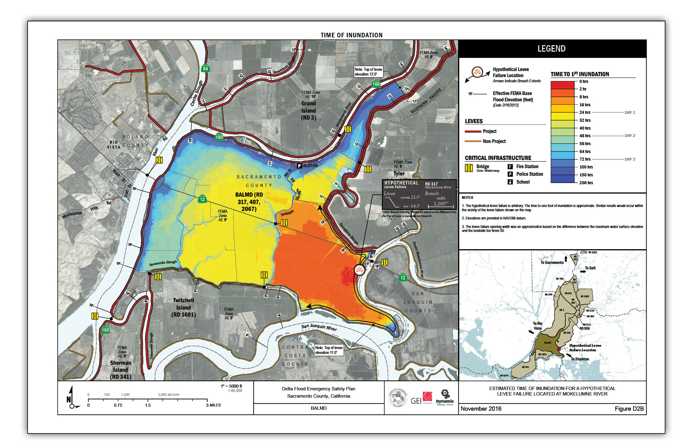
Map production is automated over 25 individual hypothetical levee breach scenarios.
[cs_divider cs_divider_style=”zigzag” cs_divider_backtotop=”yes” cs_divider_margin_top=”3″ cs_divider_margin_bottom=”3″ cs_divider_height=”3″]
San Mateo County Community College District Student Equity Mapping
