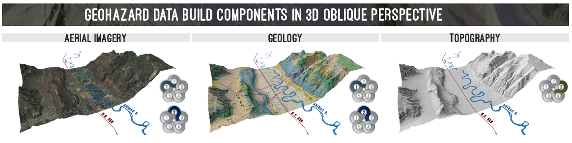
As part of the Hazard Mitigation Plan Update for La Plata County, we developed a geohazard layer in collaboration with the La Plata County Planning and Building Departments, and Colorado Geological Survey. The developed geohazard information may be used as part of the land use application process Feasibility Evaluation. This mapping was also used to develop a Geologic Hazards Decision Matrix which identifies the hazards associated with geologic map units.