Dynamic Planning + Science worked with the City of Vacaville, California, to develop its 2016 Single-Jurisdiction Local Hazard Mitigation Plan (LHMP), transitioning the City from its previous participation as an annex to a regional multi-jurisdictional plan to a comprehensive, stand-alone mitigation plan focused specifically on Vacaville’s hazards, vulnerabilities, assets, and mitigation priorities. The plan was prepared in accordance with the Disaster Mitigation Act of 2000 and 44 CFR §201.6, providing the City with a framework for reducing long-term natural hazard risk while maintaining eligibility for applicable federal hazard mitigation and disaster assistance programs.
DP+S facilitated the planning process, coordinated City departments and regional stakeholders, conducted public outreach, developed hazard profiles and GIS-based vulnerability analyses, evaluated existing mitigation capabilities, and worked with the Planning Committee to develop and prioritize mitigation actions. The resulting LHMP provided the City with a practical blueprint for short- and long-term risk reduction, interagency coordination, public engagement, and continued implementation and monitoring of mitigation activities.
The project substantially expanded upon Vacaville’s previous mitigation planning efforts through City-specific hazard data, detailed GIS overlay analyses, Hazus-MH loss estimation, updated historical disaster information, an expanded community profile, targeted public outreach, and prioritized mitigation actions.
- Developed a FEMA-compliant, single-jurisdiction LHMP specifically tailored to the City of Vacaville, replacing the City's previous approach as an annex to the regional ABAG mitigation plan.
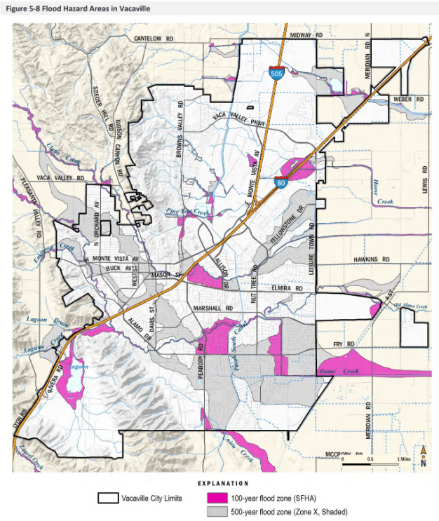
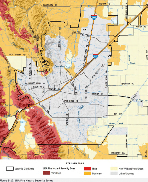
- Evaluated a comprehensive range of natural hazards, including flooding, wildfire, earthquake/liquefaction, drought, dam failure, extreme heat, landslides, climate change, and severe weather.
- Conducted detailed GIS-based vulnerability and exposure analyses evaluating population, parcel values, critical facilities, infrastructure, and other community assets within identified hazard areas.
- Used Hazus-MH and GIS spatial analysis to estimate potential losses, develop earthquake scenarios, identify high-loss areas, and support parcel-level risk assessment.
- Developed an extensive public and stakeholder engagement program, including Planning Committee meetings, workshops, a community open house, surveys, project information, and opportunities for public review and comment.
- Used GIS-based targeted outreach, intersecting high-hazard areas with County parcel and assessor data to identify and directly reach property owners most exposed to natural hazards.
- Integrated information from existing City plans and local, state, and federal datasets, including the City's General Plan, floodplain mapping, NFIP information, earthquake data, drought planning resources, wildfire information, and other technical studies.
- Completed a comprehensive capabilities assessment evaluating the City's technical, administrative, financial, regulatory, and planning resources available to implement mitigation projects.
- Established procedures for ongoing implementation, monitoring, evaluation, public involvement, and future LHMP updates, helping ensure the plan remained an active risk-reduction tool rather than a stand-alone planning document.